Apple Maps Launches Revamped Data Collection WebsiteAs part of its efforts to
rebuild Apple Maps "from the ground up," Apple has been collecting street-level data with LiDAR-equipped vehicles
for over three years. Apple also deployed
employees wearing LiDAR-equipped backpacks to collect pedestrian-based data starting in California late last year.
<img src="

" alt="" width="800" height="786" class="aligncenter size-large wp-image-678697" />
As these efforts expand around the world, Apple recently transitioned to a revamped
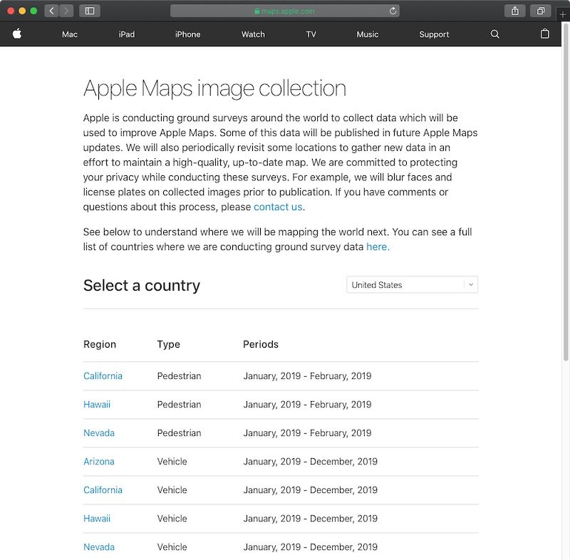
Apple Maps image collection website with a list of locations it will be surveying both in vehicles and on foot in the upcoming months.
The page reveals a few new pieces of information, including that pedestrian-based data collection has expanded to Hawaii and Nevada through February. Vehicle-based data collection will also be expanding to the tiny European country of Andorra, landlocked between France and Spain, in April 2019.
The new page, which replaces the previous
Apple Maps vehicles list, also indicates that Apple will "periodically revisit some locations to gather new data in an effort to maintain a high-quality, up-to-date map."
Apple Maps vehicles have been collecting mapping data in the United States since 2015, with over 45 states at least partially surveyed to date. The vehicles have also surveyed parts of Croatia, France, Ireland, Italy, Japan, Portugal, Slovenia, Spain, Sweden, and the United Kingdom, according to Apple.
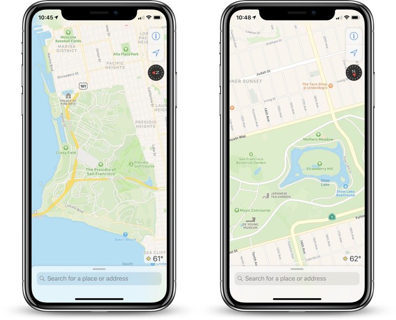
Back in June 2018, Apple said the revamped mapping data would roll out section by section across the rest of the United States over the following year. The improvements
first rolled out in Northern California in
iOS 12 and have extended to Hawaii and Southern California over the past few months.
<img src="

" alt="" width="800" height="646" class="aligncenter size-large wp-image-644619" />
The overall look and feel of <!---->Apple Maps<!----> is mostly the same, but zooming and panning reveals more details like grass, trees, sports fields, and parking lots. Apple also said search results would become more relevant.
<div class="linkback">Tags:
Apple Maps,
Apple Maps vehicles</div>
This article, "
Apple Maps Launches Revamped Data Collection Website" first appeared on
MacRumors.comDiscuss this article in our forums
<div class="feedflare">
<img src="[url]http://feeds.feedburner.com/~ff/MacRumors-Front?d=yIl2AUoC8zA" border="0"></img>[/url]
<img src="[url]http://feeds.feedburner.com/~ff/MacRumors-Front?d=6W8y8wAjSf4" border="0"></img>[/url]
<img src="[url]http://feeds.feedburner.com/~ff/MacRumors-Front?d=qj6IDK7rITs" border="0"></img>[/url]
</div><img src="
http://feeds.feedburner.com/~r/MacRumors-Front/~4/OhNJ5mPIxTw" height="1" width="1" alt=""/>
Source:
Apple Maps Launches Revamped Data Collection Website